Dronelink is a versatile app designed for DJI drones, offering advanced flight planning and automation capabilities. In this blog post, we’ll explore various aspects of Dronelink, including its features, comparisons with other apps, and specific use cases. We’ll also address common questions about its functionality with different DJI drone models.
Key Features of Dronelink
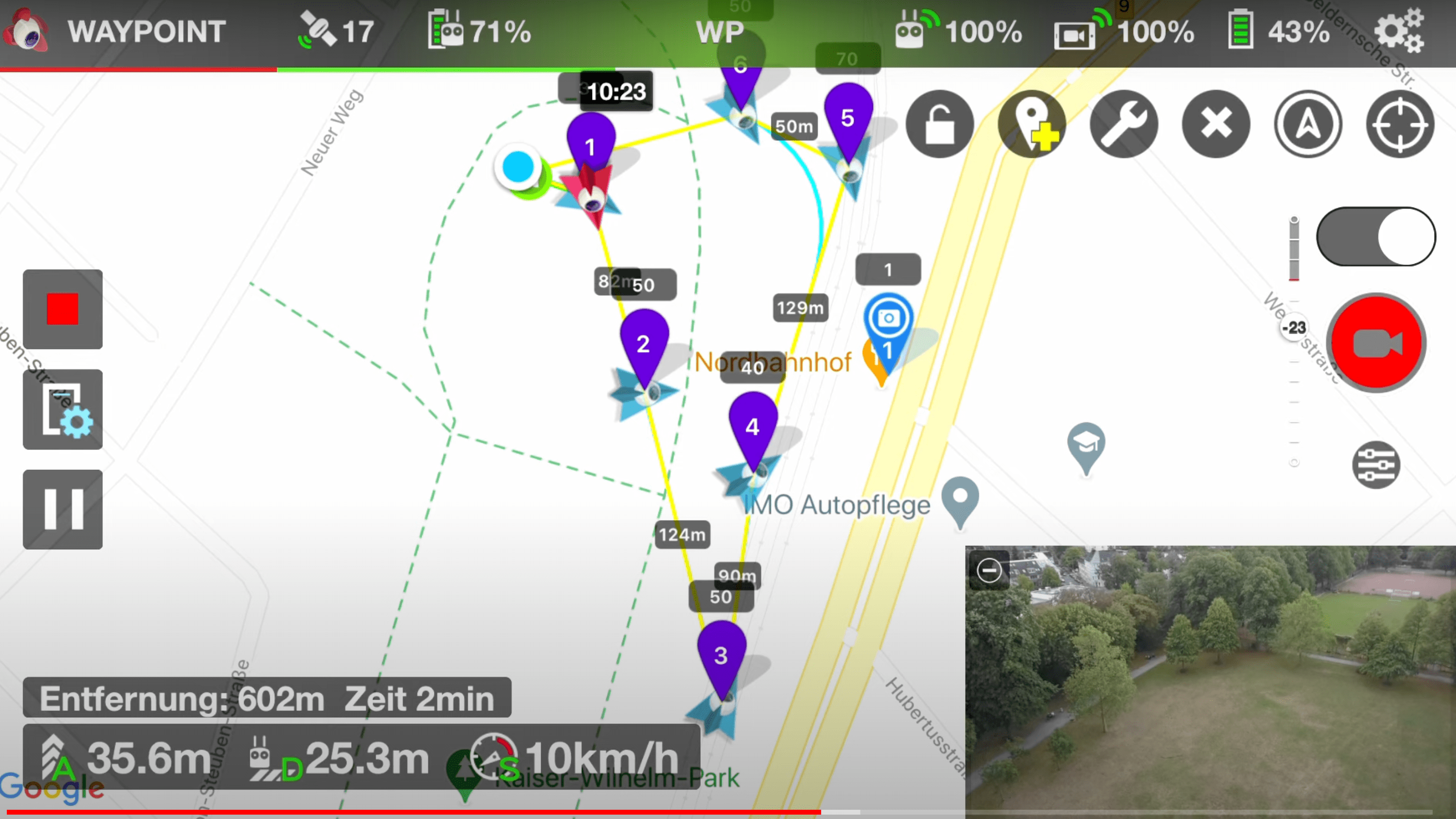
Dronelink offers a robust set of features aimed at enhancing your drone flight experience:
- Advanced Flight Planning: Create detailed and automated flight plans with waypoints, actions, and more.
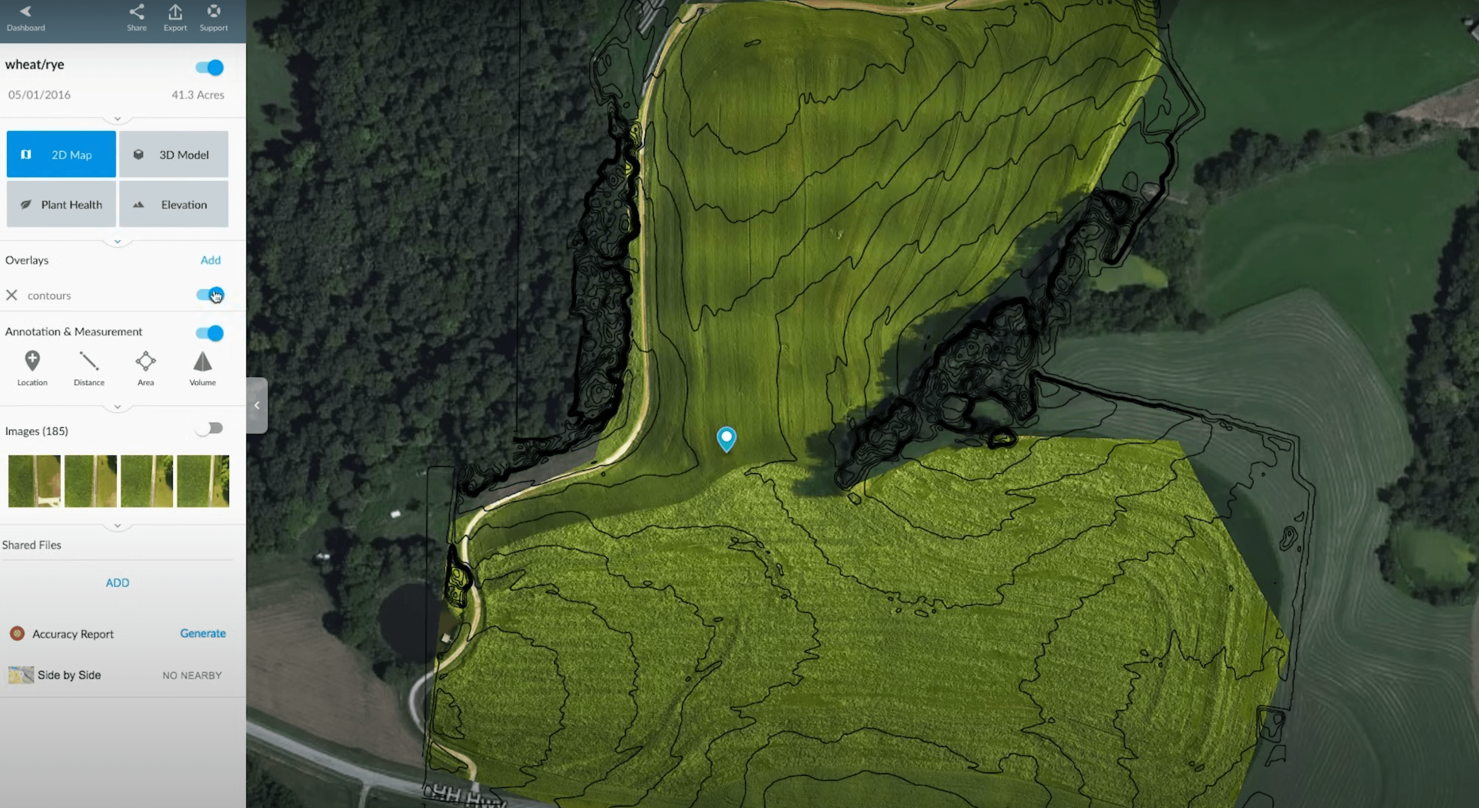
- 3D Mapping: Capture detailed 3D maps and models, ideal for surveying and inspection tasks.
- Real-Time Collaboration: Share flight plans and collaborate with team members in real-time.
- Mission Automation: Automate complex missions for consistent and repeatable flight paths.
Dronelink for DJI Mini 3 Pro
The Dronelink app is fully compatible with the DJI Mini 3 Pro, making it an excellent choice for users of this compact and powerful drone. With Dronelink, Mini 3 Pro pilots can leverage advanced features like waypoint missions, automated flight paths, and real-time collaboration, significantly enhancing the capabilities of their drone.
Dronelink vs. Litchi
When comparing Dronelink and Litchi, several key differences emerge:
- Flight Planning: Both apps offer waypoint missions, but Dronelink provides more detailed automation and scripting capabilities.
- User Interface: Litchi is known for its user-friendly interface, while Dronelink offers more customization and control options.
- Compatibility: Both apps support a wide range of DJI drones, but checking the latest compatibility list is always recommended.
Dronelink vs. DroneDeploy
DroneDeploy is another popular app for drone pilots, particularly in commercial applications. Here’s how it compares to Dronelink:
- 3D Mapping: Both apps excel in 3D mapping, but Dronelink offers more flexible mission planning.
- Industry Use: DroneDeploy is widely used in agriculture, construction, and surveying, while Dronelink’s versatile features make it suitable for a broader range of applications.
- Cost: Pricing models differ, with Dronelink offering more affordable options for hobbyists and small businesses.
Getting Started with Dronelink
- Create an Account: Sign up for a Dronelink account to access its features and start planning missions.
- Download the App: Available on both iOS and Android, download the Dronelink app to your mobile device.
- Plan Missions: Use the app to create and simulate flight plans before executing them with your drone.
- Integrate with DJI Drones: Ensure your DJI drone is compatible and follow the setup instructions to connect.
Specific Use Cases
- 3D Mapping: Use Dronelink for detailed 3D mapping projects, ideal for construction and land surveying.
- Surveying: Automate flight paths to gather consistent data for large areas.
- Inspection: Plan precise missions for inspecting infrastructure, such as bridges and power lines.
Dronelink for DJI Air 2S
The DJI Air 2S is another model that pairs well with Dronelink. Users can take advantage of the app’s advanced features to maximize the drone’s capabilities, from capturing high-resolution imagery to conducting detailed inspections.
Alternatives to Dronelink
While Dronelink is powerful, some users might seek alternatives based on specific needs:
- Pix4D: Excellent for photogrammetry and mapping.
- DroneDeploy: Great for industry-specific applications like agriculture and construction.
- Litchi: User-friendly and perfect for hobbyists seeking enhanced flight modes.
Conclusion
Dronelink is a powerful tool for DJI drone users, offering advanced features for flight planning, 3D mapping, and mission automation. Whether you’re using a Mini 3 Pro or an Air 2S, Dronelink enhances your drone’s capabilities. By comparing it with other apps like Litchi and DroneDeploy, you can choose the best tool for your specific needs.
For more info about Dronelink visit https://www.dronelink.com/






Leave a Reply