Key Takeaways
- Understand the Physics: GPS multipath occurs when satellite signals bounce off skyscrapers, causing the drone to miscalculate its position.
- Master Manual Control: Proficiency in ATTI mode is the only reliable fallback when automation fails in urban canyons.
- Visual Positioning Limits: While 2026 vision sensors are advanced, glass surfaces and low light can render them useless in city environments.
- Strategic Launch Points: Launching from open areas or rooftops is safer than launching from deep street-level "canyons."
As a specialist in navigation systems, I often tell pilots that the most dangerous environment for a drone isn't a windy coastline or a snowy mountain; it is the concrete jungle. In 2026, we have seen massive leaps in Global Navigation Satellite System (GNSS) technology, including widespread adoption of multi-band receivers (L1/L5). Yet, one physics-based adversary remains undefeated: GPS multipath interference.
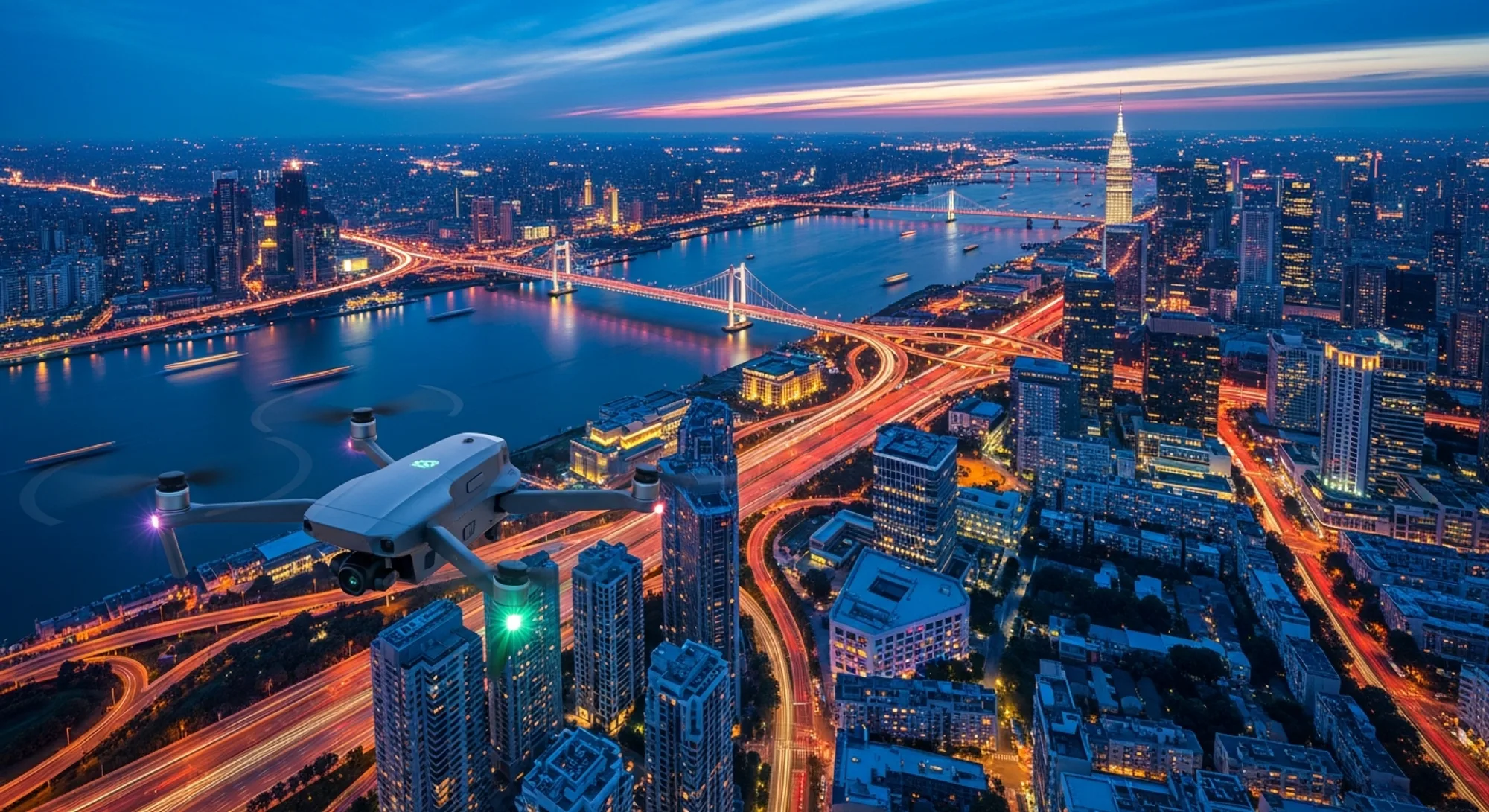
For commercial pilots conducting real estate surveys, façade inspections, or cinematic city shots, the "Urban Canyon"—narrow streets flanked by tall buildings—is a navigation nightmare. In this urban drone flying guide, we will dissect the mechanics of signal reflection, analyze why modern tech still struggles, and outline the critical skills required to survive the city.
The Physics of Deception: What is Multipath Interference?
To understand why drones crash in cities, you must understand how they see the world. Your drone determines its position by measuring the time it takes for a signal to travel from a satellite to its receiver. This calculation relies on the assumption that the signal traveled in a straight line.
In an urban environment, this assumption falls apart. When flying drones near buildings, satellite signals bounce off glass, steel, and concrete facades before hitting the drone. This reflected signal travels a longer path than a direct line-of-sight signal. The drone's computer calculates the distance based on this delayed time, leading it to believe it is several meters away from its actual location.
This is GPS multipath interference. When the drone's flight controller receives conflicting data—direct signals saying one thing and reflected signals saying another—the Kalman filter (the algorithm estimating the drone's state) can become unstable. The result is often a sudden, uncommanded lurch into the very building you were trying to film.
Recognizing the "Toilet Bowl" Effect
Before a crash occurs, the drone usually gives you warning signs. The most infamous is the "Toilet Bowl Effect" (TBE). This happens when the drone attempts to hold a hover but drifts due to GPS error. The flight controller tries to correct the drift, but because its positional data is wrong, the correction actually pushes the drone further off course.
The drone then tries to correct that error, creating a circular motion that grows larger and faster—like water swirling down a drain. If you do not intervene immediately, the centrifugal force will eventually slam the aircraft into an obstacle.
Other signs of imminent drone signal loss or degradation include:
- Sudden Altitude Shifts: Vertical position is often the first to degrade during multipath events.
- Map Drift: The drone icon on your controller screen appears to be moving through buildings or floating blocks away from your visual line of sight.
- Compass Errors: Large metal structures (steel reinforcement in concrete) can cause magnetic interference, confusing the drone's heading just as GPS confuses its location.
For a deeper dive into the technical specifications of satellite positioning, refer to our analysis on Drone Navigation Systems (2026).
The Pilot's Safety Net: ATTI Mode Training
In 2026, automation is seductive. Obstacle avoidance and station holding are so good that many pilots forget how to actually fly. However, in an Urban Canyon, automation is your enemy. When GPS fails, you must switch to Attitude (ATTI) mode immediately.
In ATTI mode, the drone maintains its altitude (via barometer) and stabilization (via gyroscope) but does not hold its horizontal position. It will drift with the wind. ATTI mode training is the single most important skill for urban pilots. You must be able to counteract wind drift manually while keeping the drone oriented correctly.
Pro Tip: Many consumer drones in 2026 hide ATTI mode deep in the settings or only activate it automatically upon signal loss. For professional urban work, use enterprise-grade drones that allow a manual toggle to ATTI mode. If your drone lacks this, practice flying in open fields with vision sensors disabled and sticks taped to simulate drift.
If you are looking to professionalize your skills, organizations like the Pilot Institute offer specific modules on emergency maneuvers that go beyond the standard Part 107 requirements.
GNSS Accuracy 2026: Why Dual-Band Isn't a Cure-All
A common misconception is that GNSS accuracy 2026 standards, specifically dual-band GPS (L1+L5), eliminate multipath issues. While L5 signals are more robust and better at distinguishing direct signals from reflections, they are not magic.
In deep urban canyons, the sky view might be limited to less than 30%. Even if you are connected to 12 satellites, if they are all clustered in a narrow strip of sky directly above, your "Geometric Dilution of Precision" (GDOP) is poor. The triangulation geometry is weak, meaning even small signal errors result in massive positional deviations.
Furthermore, Real-Time Kinematic (RTK) modules, often used for mapping, can sometimes struggle more in these environments. RTK relies on carrier-phase tracking, which is highly susceptible to cycle slips caused by interruptions from buildings. For a look at how enterprise drones handle these complex environments, read our report on Autonomous Inspection trends.
Reliance on Visual Positioning Systems (VPS)
Modern drones utilize Visual Positioning Systems (downward and forward-facing cameras) to stabilize the aircraft when GPS is weak. This is often what saves a drone in an alleyway.
However, VPS has distinct limitations in cities:
- Glass Surfaces: Reflective skyscrapers can confuse obstacle avoidance sensors and visual odometry.
- Moving Reference Points: If you are hovering over moving traffic or flowing water, the VPS may lock onto the movement and cause the drone to drift in the opposite direction.
- Low Light: Urban flying often happens at twilight for cinematic effect. Most VPS sensors degrade rapidly in low light.
It is vital to ensure your drone is compliant with regulations while navigating these spaces. See our guide on Remote ID Compliance to ensure your signal broadcasting doesn't add to your troubles.
Pre-Flight Planning to Mitigate Multipath
Avoiding a crash starts before you power on the drone. Here is a strategic checklist for urban operations:
- Analyze Satellite Geometry: Use apps that show satellite positions (AR views). You want satellites distributed across the horizon, not just directly overhead.
- Choose the Right Launch Point: Never launch from the bottom of a "canyon." Launching from a parking garage roof or an open park allows the drone to lock onto a clean GPS signal before entering the interference zone.
- Set Return-to-Home (RTH) to "Hover": In an urban canyon, a standard RTH that ascends to a preset altitude might drive the drone into an overhang or bridge. Setting it to "Hover" allows you to walk toward the drone to regain control.
- Check Solar Activity: High K-index (solar storms) combined with multipath interference is a recipe for a flyaway.
Always adhere to federal guidelines regarding flight over people and moving vehicles. The FAA Safety website provides current protocols for operating in congested areas.
Emergency Recovery Protocol
If you find yourself experiencing severe multipath glitches while flying drones near buildings, follow this protocol:
- Stop Input: Release the sticks for a split second to see how the drone behaves. Is it drifting?
- Switch to ATTI: If the drone is fighting you or toilet-bowling, disengage GPS immediately.
- Climb Out (If Safe): Rising vertically often clears the obstruction causing the reflection and improves satellite geometry.
- Visualize, Don't Trust: Ignore the map screen. Fly strictly by Line of Sight (VLOS).
Urban flying requires a blend of advanced technology and old-school piloting skills. By understanding the invisible landscape of radio waves as well as the physical landscape of concrete, you can capture stunning imagery without becoming a statistic.
Sources & Further Reading
- FAA Safety - Recreational Flyers & Modeler Community-Based Organizations
- Pilot Institute - Professional Drone Pilot Training & Certification
- NASA UTM - Unmanned Aircraft System Traffic Management Research