Key Takeaways
- Accuracy Gap: Standard GPS offers 3–5 meter accuracy, while RTK achieves 1–2 centimeter precision, critical for survey-grade deliverables.
- ROI Calculation: The RTK module worth it threshold is approximately 50 mapping acres per month; below that, Ground Control Points (GCPs) with standard GPS may be more cost-effective.
- Workflow Efficiency: RTK reduces field time by up to 75% by minimizing the need to lay out and measure physical GCPs across difficult terrain.
- Signal Dependency: In 2026, network RTK (NTRIP) is the standard, but local base stations remain superior for remote areas lacking cellular coverage.
In the early days of commercial drone adoption, the difference between a consumer toy and an enterprise tool was often just the camera. In 2026, the dividing line is defined by navigation. For professional pilots and fleet managers, the decision to invest in Real-Time Kinematic (RTK) positioning versus relying on standard Global Positioning System (GPS) modules is no longer just a technical preference—it is a fundamental business calculation.
As a drone journalist analyzing aerospace technology, I have watched the "centimeter war" unfold. Five years ago, RTK was a $10,000 luxury reserved for high-end agrarian sprayers and industrial inspection units. Today, modular RTK attachments are available for prosumer airframes, blurring the lines between enthusiast gear and survey instruments. However, the price of entry remains significant. An RTK-equipped setup can cost $1,500 to $3,000 more than its standard counterpart, not including base stations or network subscriptions.
This commercial drone buying guide 2026 executes a forensic audit of the technology. We will strip away the marketing hype to determine if the precision upgrade is a necessary asset or an overpriced redundancy for your specific flight operations.
The Technical Divide: GNSS Positioning Analysis
To understand the value proposition, we must first decode the underlying technology. Most standard drones rely on a GNSS (Global Navigation Satellite System) receiver that tracks signals from GPS (USA), GLONASS (Russia), Galileo (EU), and BeiDou (China) constellations. This receiver measures the time it takes for a signal to travel from the satellite to the drone to calculate position.
However, as signals travel through the ionosphere and troposphere, they suffer from atmospheric delays. In a standard GNSS positioning analysis, these errors result in a fluctuating position accuracy of roughly 3 to 5 meters (10–16 feet). For a photographer framing a sunset, a 3-meter drift is irrelevant. For a surveyor mapping a construction site where property lines are contested, a 3-meter error is a lawsuit waiting to happen.
How RTK Fixes the Drift
RTK (Real-Time Kinematic) corrects these atmospheric errors in real-time. It requires two receivers: a static "Base Station" (which can be a physical tripod on the ground or a virtual reference station via the internet) and the "Rover" (the drone).
Because the Base Station knows its exact fixed location on Earth, it can calculate the real-time errors in the satellite signals. It transmits correction data to the drone, allowing the drone to align its phase measurements. The result is RTK vs GPS accuracy that shifts from meters to centimeters—typically 1cm + 1ppm (parts per million) horizontally.
Elena’s Tech Note: Do not confuse RTK with "Vision Positioning." While obstacle avoidance sensors help a drone hover steadily indoors, they do not geotag your photos with global coordinates. Only RTK or PPK (Post-Processed Kinematic) writes centimeter-level coordinates directly into the image EXIF data.
The 2026 Cost Analysis: Is the RTK Module Worth It?
The hardware landscape has shifted. In 2026, manufacturers like DJI and Autel have largely moved toward modular ecosystems for their mid-tier enterprise drones. This allows pilots to attach an RTK module to the top of the airframe via a USB-C or proprietary port.
When evaluating the survey grade drone cost, you must look beyond the sticker price of the drone itself. Here is the breakdown of the "Precision Premium" in the current market:
- The Module: Dedicated RTK modules for Mavic 3 Enterprise or Autel EVO Max series typically range from $600 to $900.
- The Base Station: A proprietary mobile station (like the D-RTK 2) costs between $2,500 and $3,500.
- Network Subscriptions (NTRIP): If you forgo the physical base station and use a cellular network correction service, expect to pay $150 to $400 monthly depending on the provider and state coverage.
If you are trying to decode the spec sheet of a potential purchase, you will notice that an RTK-ready bundle is significantly more expensive than a standard "Fly More" combo. The question is: does your billing model support this?
ROI Audit: Mapping and Photogrammetry
The primary driver for RTK adoption is photogrammetry. If you are creating 2D orthomosaics or 3D digital twins, the drone mapping ROI is calculated by time saved on the ground, not in the air.
The GCP Factor
Without RTK, creating a survey-grade map requires Ground Control Points (GCPs). These are physical targets placed on the ground and measured with a high-precision GPS rover stick. To map a 50-acre site accurately with a standard GPS drone, a pilot might need to lay out and measure 10 to 15 GCPs. This process can take 2 to 4 hours in difficult terrain.
With an RTK drone, the photos are geotagged with precise coordinates. While you should still use 1 or 2 checkpoints for validation, you eliminate the need for the dense grid of GCPs. This reduces ground time from hours to minutes.
If you bill your services at $150/hour, saving 3 hours per site translates to $450 in savings per project. Consequently, the $3,000 investment in RTK hardware pays for itself after roughly 7 mapping missions. If you map weekly, the upgrade is mandatory. If you map quarterly, standard GPS with GCPs may be more fiscally responsible.
For those conducting specialized imaging, such as low-altitude 360 captures, precision is also vital to prevent stitching errors. You can read more about how stability impacts stitching in our guide on how to fix parallax stitching.
Operational Use Cases: Who Needs RTK?
Not every enterprise pilot needs centimeter precision. In 2026, the market has segmented into three distinct user groups. Identifying which group you belong to is the fastest way to validate your purchase.
1. The Visual Inspector (RTK: Optional)
If your primary deliverables are high-resolution JPEGs of cell towers, roof inspections, or real estate marketing videos, RTK is generally overkill. While RTK provides better wind resistance and hovering stability, modern standard GPS drones are sufficiently stable for visual inspection. The client cares about the crack in the concrete, not the precise latitude of the drone when the photo was taken.
2. The Automated Patrol (RTK: Recommended)
For security teams or construction progress monitoring where the drone must fly the exact same path every week to create a timelapse, RTK is superior. Standard GPS can drift several meters between flights. An RTK-enabled drone will hit the exact same waypoint in 3D space, ensuring the camera angle matches perfectly from week 1 to week 50. This repeatability is crucial for automated "drone-in-a-box" solutions.
3. The Surveyor / Mapper (RTK: Mandatory)
For topographic surveys, volumetric stockpile measurements, or construction site overlay, RTK is the industry standard. Delivering a map with 3-meter global shift errors to a civil engineer is unacceptable in 2026. While PPK (processing the data after the flight) is a viable alternative, having real-time corrections provides immediate confidence in the data quality before leaving the site.
Furthermore, when selecting a drone for mapping, the camera sensor is just as important as the navigation system. A mechanical shutter is preferred to avoid rolling shutter distortion. See our analysis on fixed vs. adjustable aperture to ensure your optical stack matches your navigation precision.
Hardware Ecosystems in 2026
When purchasing, it is vital to check compatibility. Unlike memory cards, RTK modules are rarely universal. They are proprietary to the airframe manufacturer.
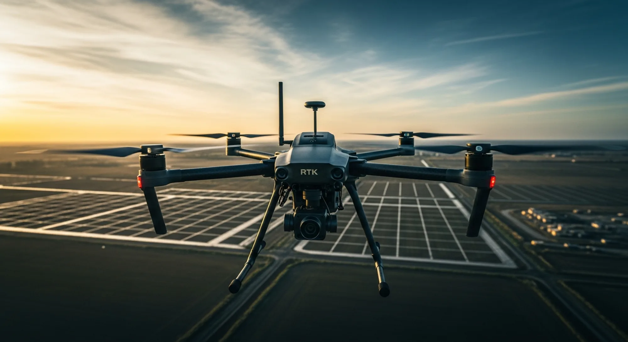
DJI Enterprise: The Mavic 3 Enterprise series remains the workhorse of the industry. The RTK module is a separate attachment sitting atop the fuselage. It is lightweight and integrates seamlessly with the DJI Pilot 2 app. For heavy-lift applications, the Matrice series features built-in dual RTK antennas, which also provide magnetic interference immunity—crucial for flying near power lines or large metal structures.
Autel Robotics: The EVO Max series features interchangeable bays that support RTK modules. Autel has focused heavily on mesh networking in 2026, allowing their RTK data to be shared across multiple drones in a swarm, a feature we discussed in our analysis of bundle values.
Skydio: While historically focused on visual navigation (VIO), Skydio's X10 platform in 2026 offers RTK integration specifically for high-precision 3D scanning, acknowledging that autonomy alone cannot solve the georeferencing requirement of enterprise clients.
The Verdict: Buy or Bypass?
The decision to upgrade to RTK in 2026 comes down to the "Deliverable Defense." If a client challenges the accuracy of your data, can you defend it?
If you are providing creative assets, standard GPS is defensible because aesthetics are subjective. If you are providing measurement data, standard GPS is indefensible without rigorous Ground Control Points. The RTK module acts as an insurance policy for data integrity.
Buy RTK If:
- You perform volumetric measurements or topographic surveys.
- You fly in areas with high magnetic interference (RTK helps mitigate compass errors).
- You require automated, repeatable flight paths for timelapse progression.
- You bill over $2,000 per mapping project.
Stick to GPS If:
- You primarily shoot video or real estate photos.
- You only map occasionally and are comfortable setting manual GCPs.
- You are on a strict budget (save the $3,000 for better lenses or batteries).
The era of "close enough" is ending. As digital twins become the standard for construction and infrastructure management, the premium for precision is becoming the baseline cost of doing business.
Sources & Further Reading
- DJI Enterprise - Official Specifications for Mavic 3 Enterprise RTK Modules.
- PCMag - Analysis of current consumer vs. enterprise drone capabilities.
- B&H Photo Video - Current market pricing for RTK modules and base stations.
- Autel Robotics - Technical details on EVO Max series positioning systems.